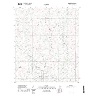
2018 Map of Brewton North
USGS Topo · Published 2018About this map
Brewton and its northern surroundings are defined by a complex network of waterways and rural settlements at the edge of the Alabama pine forests. The landscape is carved by Murder Creek and Burnt Corn Cr, which wind through lowlands dotted with small ponds and larger basins like Moran Lake One and Lake McMillan. Significant for family historians, the area is home to several well-placed burial grounds, including Calvary Cem and Weaver Cem.
Find a feature on this map
99 named features on this map. Tap any name to fly to it.
Don’t see what you’re looking for? This feature index may not catch every label — zoom into the map to look around manually.
Map Details
Editions of this 2018 Brewton North Map
This is the sole edition of this map. No revisions or reprints were ever made.
Other maps of this area

1953 · Andalusia
USGS Topo · 1:250,000

1957 · Andalusia
USGS Topo · 1:250,000

1959 · Brewton South
USGS Topo · 1:24,000

1960 · Brewton South
USGS Topo · 1:24,000

1960 · Pollard
USGS Topo · 1:24,000

1960 · Brewton North
USGS Topo · 1:24,000

1960 · Wallace
USGS Topo · 1:24,000

1971 · Range
USGS Topo · 1:24,000

1971 · Castleberry
USGS Topo · 1:24,000

1982 · Shipps Creek
USGS Topo · 1:24,000