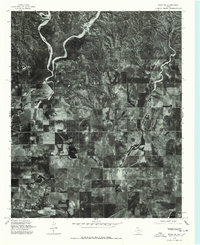
1976 Map of Brice NE
USGS Topo · Published 1978About this map
The community of Lesley serves as a focal point for this 1976 orthophoto study of the Hall County landscape. This imagery-based map provides a clear look at the agricultural patterns and dendritic drainage systems that characterize the Texas Panhandle during the mid-1970s. The distinct geometry of section lines and cultivated fields contrasts with the winding paths of seasonal creeks and the dark pocket of Hancock Lake. These orthophotographs were captured shortly after New Year's Day, revealing the terrain's bare-earth structure and hydrological features without the masking of summer foliage. Researchers can observe the exact footprint of farmsteads and rural infrastructure as they existed before decades of further agricultural consolidation and change.
Find a feature on this map
2 named features on this map. Tap any name to fly to it.
Don’t see what you’re looking for? This feature index may not catch every label — zoom into the map to look around manually.
Map Details
Editions of this 1976 Brice NE Map
This is the sole edition of this map. No revisions or reprints were ever made.
Other maps of this area

1954 · Plainview
USGS Topo · 1:250,000

1958 · Plainview
USGS Topo · 1:250,000

1960 · Brice
USGS Topo · 1:62,500

1961 · Memphis
USGS Topo · 1:62,500

1963 · Hedley
USGS Topo · 1:24,000

1963 · Clarendon SE
USGS Topo · 1:24,000

1963 · Clarendon SW
USGS Topo · 1:24,000

1976 · Brice SE
USGS Topo · 1:24,000

1976 · Brice NW
USGS Topo · 1:24,000

1976 · Memphis NW
USGS Topo · 1:24,000