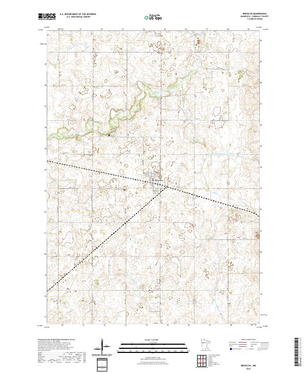
2022 Map of Bricelyn
USGS Topo · Published 2022About this map
Bricelyn serves as the central hub of this agricultural landscape in Faribault County, characterized by a highly managed water system designed for prairie drainage. The town's layout is clearly defined by local streets such as N 5th St and N 4th St, providing a detailed look at the modern settlement footprint. Outside the residential center, the terrain is dominated by a complex network of man-made waterways, including County Ditch Number Fifty five and County Ditch Number Seventy eight, which intersect with natural features like the E Br Blue Earth River and Brush Cr.
Find a feature on this map
28 named features on this map. Tap any name to fly to it.
Don’t see what you’re looking for? This feature index may not catch every label — zoom into the map to look around manually.
Map Details
Editions of this 2022 Bricelyn Map
This is the sole edition of this map. No revisions or reprints were ever made.
Other maps of this area

1954 · Mason City
USGS Topo · 1:250,000

1955 · Bricelyn
USGS Topo · 1:62,500

1955 · Wells
USGS Topo · 1:62,500

1957 · Mason City
USGS Topo · 1:250,000

1958 · Mason City
USGS Topo · 1:250,000

1972 · Buffalo Center
USGS Topo · 1:24,000

1972 · Buffalo Center NE
USGS Topo · 1:24,000

1972 · Vinje
USGS Topo · 1:24,000
1982 · Bricelyn
USGS Topo · 1:24,000
1982 · Kiester
USGS Topo · 1:24,000