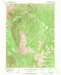
1948 Map of Bridal Veil Falls
USGS Topo · Published 1971About this map
Provo River cuts a deep path through the Wasatch Range on this 1948 survey, revised in 1969. The canyon floor is a hub of mid-century activity, where the Denver and Rio Grande Western railroad and the Alpine Scenic Highway parallel the water. Small settlements like Wildwood, Vivian Park, and Springdell serve as gateways to the steep drainages of the Uinta National Forest.
Find a feature on this map
51 named features on this map. Tap any name to fly to it.
Don’t see what you’re looking for? This feature index may not catch every label — zoom into the map to look around manually.
Map Details
Editions of this 1948 Bridal Veil Falls Map
4 editions found
Other maps of this area

1885 · Salt Lake
USGS Topo · 1:250,000

1907 · Strawberry Valley
USGS Topo · 1:125,000

1909 · Strawberry Valley
USGS Topo · 1:125,000

1948 · Timpanogos Cave
USGS Topo · 1:24,000

1948 · Orem
USGS Topo · 1:24,000

1948 · Orem
USGS Topo · 1:62,500

1948 · Springville
USGS Topo · 1:24,000

1948 · Aspen Grove
USGS Topo · 1:24,000

1948 · Provo
USGS Topo · 1:24,000

1948 · Bridal Veil Falls
USGS Topo · 1:24,000