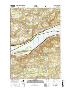
2017 Map of Bridal Veil
USGS Topo · Published 2017About this map
The Columbia River carves a path between Oregon and Washington in this recent survey, showcasing the dramatic transition from the riverbanks to the high ridges of the Gifford Pinchot National Forest and Mount Hood National Forest. Along the southern shore, the community of Bridal Veil sits amidst a landscape defined by vertical relief and famous cataracts, including Upper Latourell Falls and Wahkeena Falls. The mapping details the intricate transport and topographic features of the gorge, from the landmark Crown Point and the rock formations of the Pillars of Hercules to the river-level Broughton Reach. On the northern bank, the settlements of Prindle and Cruzatt are flanked by Biddle Butte and the winding Washougal River. Notable for its high density of named water features and geological landmarks, this map records the modern configuration of the Gorge's most recognizable sites, including Angels Rest and the small Brown's Cape Horn Airport.
Find a feature on this map
109 named features on this map. Tap any name to fly to it.
Don’t see what you’re looking for? This feature index may not catch every label — zoom into the map to look around manually.
Map Details
Editions of this 2017 Bridal Veil Map
This is the sole edition of this map. No revisions or reprints were ever made.
Other maps of this area

1911 · Boring
USGS Topo · 1:48,000

1914 · Boring
USGS Topo · 1:62,500

1916 · Estacada
USGS Topo · 1:125,000

1918 · Troutdale
USGS Topo · 1:62,500

1934 · Troutdale
USGS Topo · 1:48,000

1940 · Boring
USGS Topo · 1:62,500

1941 · Camas
USGS Topo · 1:62,500

1942 · Camas
USGS Topo · 1:62,500

1948 · Vancouver
USGS Topo · 1:250,000

1950 · Vancouver
USGS Topo · 1:250,000