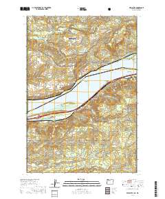
2020 Map of Bridal Veil
USGS Topo · Published 2020About this map
Bridal Veil and Latourell sit atop the steep bluffs overlooking the Columbia River, marking a landscape where the river’s reach has dictated settlement and infrastructure for generations. This 2020 map documents the complex topography of the Gorge, where the boundary between Washington and Oregon splits the river current between Skamania and Multnomah counties. The transition from the river-level Broughton Reach to the towering heights of Crown Point and Angels Rest highlights the extreme elevation changes that define this region.
Find a feature on this map
94 named features on this map. Tap any name to fly to it.
Don’t see what you’re looking for? This feature index may not catch every label — zoom into the map to look around manually.
Map Details
Editions of this 2020 Bridal Veil Map
This is the sole edition of this map. No revisions or reprints were ever made.
Other maps of this area

1911 · Boring
USGS Topo · 1:48,000

1914 · Boring
USGS Topo · 1:62,500

1916 · Estacada
USGS Topo · 1:125,000

1918 · Troutdale
USGS Topo · 1:62,500

1934 · Troutdale
USGS Topo · 1:48,000

1940 · Boring
USGS Topo · 1:62,500

1941 · Camas
USGS Topo · 1:62,500

1942 · Camas
USGS Topo · 1:62,500

1948 · Vancouver
USGS Topo · 1:250,000

1950 · Vancouver
USGS Topo · 1:250,000