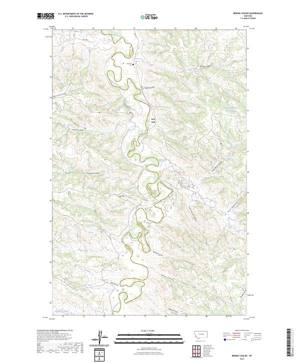
2024 Map of Bridge Coulee
USGS Topo · Published 2024About this map
Musselshell River meanders across the border of Petroleum and Garfield counties in this contemporary map of central Montana. The landscape is defined by an intricate network of drainage channels, including Bridge Coulee, Sandage Coulee, and Raundal Coulee, which carve through the high plains toward the river. This area remains largely open rangeland, marked by isolated landmarks that reflect its ranching history and sparse population. Evidence of early 21st-century water management is visible at Ezwkial Number One Reservoir in the northeast. Small, significant local markers such as the Gilfeather Cem and the Ross Hall settlement point to the deep-rooted family histories of the region. Transportation follows a legacy of older paths, with Stage Rd and Winter Rd providing essential access across the drainage of Blood Creek and Calf Creek.
Find a feature on this map
30 named features on this map. Tap any name to fly to it.
Don’t see what you’re looking for? This feature index may not catch every label — zoom into the map to look around manually.
Map Details
Editions of this 2024 Bridge Coulee Map
This is the sole edition of this map. No revisions or reprints were ever made.
Other maps of this area

1954 · Jordan
USGS Topo · 1:250,000

1954 · Lewistown
USGS Topo · 1:250,000

1956 · Jordan
USGS Topo · 1:250,000

1958 · Jordan
USGS Topo · 1:250,000

1959 · Lewistown
USGS Topo · 1:250,000

1964 · Jordan
USGS Topo · 1:250,000
1967 · Barney Pinnacle
USGS Topo · 1:24,000

1967 · Nelson Coulee
USGS Topo · 1:24,000
1967 · Fail Ranch
USGS Topo · 1:24,000
1967 · Lelig Coulee
USGS Topo · 1:24,000