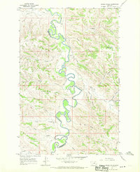
1967 Map of Bridge Coulee
USGS Topo · Published 1970About this map
The Musselshell River defines this landscape in central Montana, winding in tight, green oxbows along the boundary between Petroleum and Garfield counties. This 1967 survey captures a remote ranching territory where local life centered around small hubs like Ross Hall and the Ross Sch near the riverbanks. The terrain is characterized by a dense network of coulees, including Sandage Coulee and Bridge Coulee, which drain the surrounding plateaus toward the river valley.
Find a feature on this map
27 named features on this map. Tap any name to fly to it.
Don’t see what you’re looking for? This feature index may not catch every label — zoom into the map to look around manually.
Map Details
Editions of this 1967 Bridge Coulee Map
This is the sole edition of this map. No revisions or reprints were ever made.
Other maps of this area

1954 · Jordan
USGS Topo · 1:250,000

1954 · Lewistown
USGS Topo · 1:250,000

1956 · Jordan
USGS Topo · 1:250,000

1958 · Jordan
USGS Topo · 1:250,000

1959 · Lewistown
USGS Topo · 1:250,000

1964 · Jordan
USGS Topo · 1:250,000
1967 · Barney Pinnacle
USGS Topo · 1:24,000

1967 · Nelson Coulee
USGS Topo · 1:24,000
1967 · Fail Ranch
USGS Topo · 1:24,000
1967 · Lelig Coulee
USGS Topo · 1:24,000