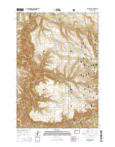
2014 Map of Bridge Creek
USGS Topo · Published 2014About this map
Camas Creek and its many tributaries carve a network of drainage basins across this part of the Umatilla National Forest. The landscape is defined by its deep incisions, including Johnson Canyon and Day Canyon, which feed into the primary watercourses. This area of Umatilla County is characterized by high plateau features like Bridge Creek Flats situated between the steep descents toward the North Fork John Day River in the south. The distribution of Twin Tank Spring, Clark Spring, and Skull Spring suggests a reliance on scattered water sources for forest management and local ecology. Movement through this terrain in the early 21st century relied on a network of Forest Service roads such as Soap Hill Rd and Texas Bar Rd, which follow the natural contours of the ridges and canyon floors.
Find a feature on this map
35 named features on this map. Tap any name to fly to it.
Don’t see what you’re looking for? This feature index may not catch every label — zoom into the map to look around manually.
Map Details
Editions of this 2014 Bridge Creek Map
This is the sole edition of this map. No revisions or reprints were ever made.
Other maps of this area

1950 · Ritter
USGS Topo · 1:62,500

1951 · Dale
USGS Topo · 1:62,500

1952 · Ritter
USGS Topo · 1:62,500

1953 · Pendleton
USGS Topo · 1:250,000

1955 · Canyon City
USGS Topo · 1:250,000

1956 · Pendleton
USGS Topo · 1:250,000

1959 · Canyon City
USGS Topo · 1:250,000

1967 · Ukiah SE
USGS Topo · 1:24,000

1967 · Bridge Creek
USGS Topo · 1:24,000

1967 · Ukiah
USGS Topo · 1:24,000