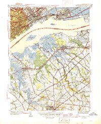
1944 Map of Bridgeport
USGS Topo · Published 1944About this map
Industrial facilities and transport networks dominate this mid-century survey of the Delaware River waterfront, where Pennsylvania and New Jersey converge. Large-scale manufacturing is anchored by the Baldwin Locomotive Works and Westinghouse Village, reflecting the wartime economic vitality of the region. On the Pennsylvania side, institutions like the Pennsylvania Military College and Crozer Theological Seminary sit near established neighborhoods like Eddystone and Upland.
Find a feature on this map
64 named features on this map. Tap any name to fly to it.
Don’t see what you’re looking for? This feature index may not catch every label — zoom into the map to look around manually.
Map Details
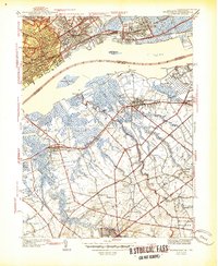
Editions of this 1944 Bridgeport Map
2 editions found
Other maps of this area

1890 · Salem
USGS Topo · 1:62,500

1890 · Glassboro
USGS Topo · 1:62,500

1891 · Philadelphia
USGS Topo · 1:62,500

1894 · Chester
USGS Topo · 1:62,500

1894 · Philadelphia
USGS Topo · 1:62,500

1896 · Philadelphia
USGS Topo · 1:62,500

1896 · Chester
USGS Topo · 1:62,500

1898 · Salem
USGS Topo · 1:62,500

1898 · Glassboro
USGS Topo · 1:62,500

1898 · Chester
USGS Topo · 1:62,500