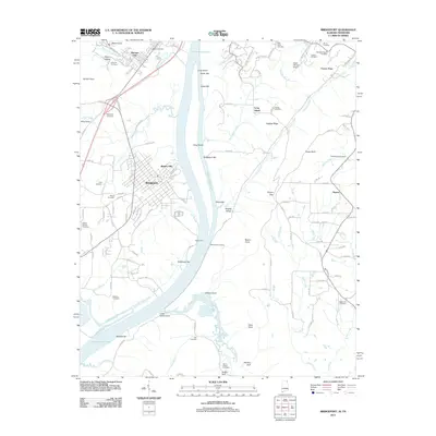
2011 Map of Bridgeport
USGS Topo · Published 2011About this map
The Guntersville Lake reservoir dominates this landscape, framing the industrial and residential heart of Bridgeport and the adjacent Richard City. The geography is defined by the Tennessee River's wide expanse, where features like Long Island and Hembrees Bar reveal the complex riverbed and island system before and after the creation of the lake. Historical transit and commerce are evident in the naming of Reese Ferry Landing and the prominence of Battery Hill, overlooking the town center.
Find a feature on this map
114 named features on this map. Tap any name to fly to it.
Don’t see what you’re looking for? This feature index may not catch every label — zoom into the map to look around manually.
Map Details
Editions of this 2011 Bridgeport Map
This is the sole edition of this map. No revisions or reprints were ever made.
Other maps of this area

1886 · Stevenson
USGS Topo · 1:125,000

1892 · Stevenson
USGS Topo · 1:125,000

1895 · Stevenson
USGS Topo · 1:125,000

1895 · Sewanee
USGS Topo · 1:125,000

1936 · Trenton
USGS Topo · 1:24,000

1936 · Shellmound
USGS Topo · 1:24,000

1936 · Orme
USGS Topo · 1:24,000

1936 · Bridgeport
USGS Topo · 1:24,000

1936 · Flat Rock
USGS Topo · 1:24,000

1936 · Stevenson
USGS Topo · 1:24,000