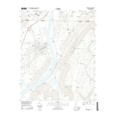
2014 Map of Bridgeport
USGS Topo · Published 2014About this map
Guntersville Lake and the Tennessee River define the central corridor of this region, where the state lines of Tennessee and Alabama meet. The industrial and residential layout of Bridgeport and South Pittsburg is visible alongside smaller settlements like Richard City and New Hope. The terrain transitions from the river valley and the expansive Long Island toward the high elevation of Sand Mountain to the southeast. Genealogists will find a high density of burial sites documented, including the Walker Family Cem, Kirkpatrick Cem, and the uniquely named Potato Hill Cem. Notable landmarks such as the Indian Hill Farm Airport and Battery Hill reflect the intersection of aviation and local geography. The map also records numerous creek systems, including Hogjaw Cr and Long Island Creek, which feed into the primary river valley.
Find a feature on this map
65 named features on this map. Tap any name to fly to it.
Don’t see what you’re looking for? This feature index may not catch every label — zoom into the map to look around manually.
Map Details
Editions of this 2014 Bridgeport Map
This is the sole edition of this map. No revisions or reprints were ever made.
Other maps of this area

1886 · Stevenson
USGS Topo · 1:125,000

1892 · Stevenson
USGS Topo · 1:125,000

1895 · Stevenson
USGS Topo · 1:125,000

1895 · Sewanee
USGS Topo · 1:125,000

1936 · Trenton
USGS Topo · 1:24,000

1936 · Shellmound
USGS Topo · 1:24,000

1936 · Orme
USGS Topo · 1:24,000

1936 · Bridgeport
USGS Topo · 1:24,000

1936 · Flat Rock
USGS Topo · 1:24,000

1936 · Stevenson
USGS Topo · 1:24,000