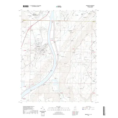
2020 Map of Bridgeport
USGS Topo · Published 2020About this map
Bridgeport occupies a strategic position along the Tennessee River where the Alabama and Tennessee state borders meet. This modern survey illustrates the enduring presence of family history in the region, noting numerous small burial grounds such as the Walker Family Cem, Richards Cem, and Whited Cem. A significant site for military history researchers is the US Military General Field Hospital Cem located near Battery Hill, pointing to the area's logistical importance in past conflicts. The landscape is defined by the river’s winding course, with features like Long Island, Hembrees Bar, and Knotts Lndg shaping the shoreline. To the east, the terrain rises sharply toward Sand Mountain and Porter Bluff, while the CSX Transportation line provides a continuous rail link through the valley between South Pittsburg and Bryant.
Find a feature on this map
139 named features on this map. Tap any name to fly to it.
Don’t see what you’re looking for? This feature index may not catch every label — zoom into the map to look around manually.
Map Details
Editions of this 2020 Bridgeport Map
This is the sole edition of this map. No revisions or reprints were ever made.
Other maps of this area

1886 · Stevenson
USGS Topo · 1:125,000

1892 · Stevenson
USGS Topo · 1:125,000

1895 · Stevenson
USGS Topo · 1:125,000

1895 · Sewanee
USGS Topo · 1:125,000

1936 · Trenton
USGS Topo · 1:24,000

1936 · Shellmound
USGS Topo · 1:24,000

1936 · Orme
USGS Topo · 1:24,000

1936 · Bridgeport
USGS Topo · 1:24,000

1936 · Flat Rock
USGS Topo · 1:24,000

1936 · Stevenson
USGS Topo · 1:24,000