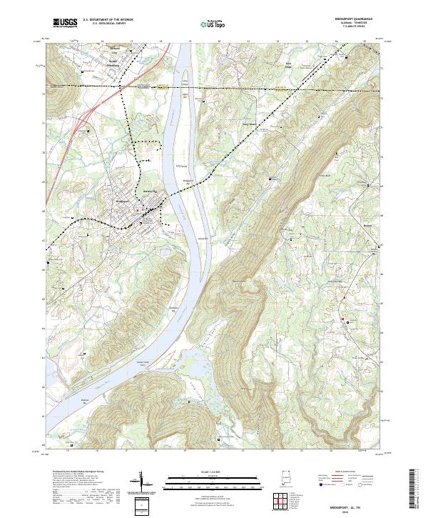
2024 Map of Bridgeport
USGS Topo · Published 2024About this map
Bridgeport occupies a strategic bend in the Tennessee River along the Alabama-Tennessee border, where the river divides around the massive Long Island. This landscape is defined by the steep transition from the river valley to the heights of Sand Mountain, featuring prominent landmarks like Battery Hill and Porter Bluff. A significant concentration of burial sites reflects the area's deep family and military history, including the US Military General Field Hospital Cem and several private plots such as the Walker Family Cem and Beene Cem.
Find a feature on this map
152 named features on this map. Tap any name to fly to it.
Don’t see what you’re looking for? This feature index may not catch every label — zoom into the map to look around manually.
Map Details
Editions of this 2024 Bridgeport Map
This is the sole edition of this map. No revisions or reprints were ever made.
Other maps of this area

1886 · Stevenson
USGS Topo · 1:125,000

1892 · Stevenson
USGS Topo · 1:125,000

1895 · Stevenson
USGS Topo · 1:125,000

1895 · Sewanee
USGS Topo · 1:125,000

1936 · Trenton
USGS Topo · 1:24,000

1936 · Shellmound
USGS Topo · 1:24,000

1936 · Orme
USGS Topo · 1:24,000

1936 · Bridgeport
USGS Topo · 1:24,000

1936 · Flat Rock
USGS Topo · 1:24,000

1936 · Stevenson
USGS Topo · 1:24,000