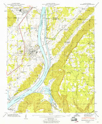
1945 Map of Bridgeport
USGS Topo · Published 1945About this map
Bridgeport serves as a vital junction along the Tennessee River during the mid-1940s, where the Nashville Chattanooga and St Louis RR crosses the broad waters of Guntersville Lake. The landscape is dominated by the transition from the river valley to the heights of Sand Mountain and Hogjaw Valley, revealing a rural pattern of life centered around small family-named landmarks and institutions. Genealogists will find a wealth of specific sites, from the Kirkpatrick Cem and James Cem to remote country schools like Long Island Sch and Crescent Hill Sch. Across the river, the Guntersville Reservation boundary marks significant public land management. Settlement is clustered at Richard City and South Pittsburg near the state line, while the southern reaches of the sheet show a more dispersed pattern of farms and mountain churches such as Harris Chapel and Mt Perron Ch.
Find a feature on this map
53 named features on this map. Tap any name to fly to it.
Don’t see what you’re looking for? This feature index may not catch every label — zoom into the map to look around manually.
Map Details
Editions of this 1945 Bridgeport Map
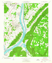
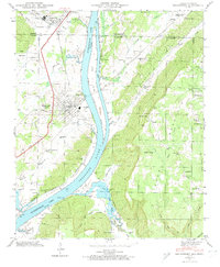
3 editions found
Other maps of this area

1886 · Stevenson
USGS Topo · 1:125,000

1892 · Stevenson
USGS Topo · 1:125,000

1895 · Stevenson
USGS Topo · 1:125,000

1895 · Sewanee
USGS Topo · 1:125,000

1936 · Trenton
USGS Topo · 1:24,000

1936 · Shellmound
USGS Topo · 1:24,000

1936 · Orme
USGS Topo · 1:24,000

1936 · Bridgeport
USGS Topo · 1:24,000

1936 · Flat Rock
USGS Topo · 1:24,000

1936 · Stevenson
USGS Topo · 1:24,000