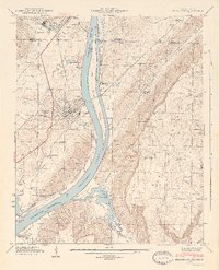
1946 Map of Bridgeport
USGS Topo · Published 1946About this map
The Tennessee River dominates this mid-1940s landscape, winding past the industrial and rail hub of Bridgeport and the expansive Long Island. Following the construction of the Guntersville Dam, the Guntersville Reservoir transformed the local topography, creating backwaters like Widows Cr and Jones Creek. The riverfront's commercial importance is evidenced by the Pumping Sta and the Reese Ferry crossing, while the town itself is bisected by the Nashville Chattanooga and St Louis Ry.
Find a feature on this map
54 named features on this map. Tap any name to fly to it.
Don’t see what you’re looking for? This feature index may not catch every label — zoom into the map to look around manually.
Map Details
Editions of this 1946 Bridgeport Map
2 editions found
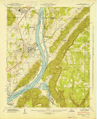
Other maps of this area

1886 · Stevenson
USGS Topo · 1:125,000

1892 · Stevenson
USGS Topo · 1:125,000

1895 · Stevenson
USGS Topo · 1:125,000

1895 · Sewanee
USGS Topo · 1:125,000

1936 · Trenton
USGS Topo · 1:24,000

1936 · Shellmound
USGS Topo · 1:24,000

1936 · Orme
USGS Topo · 1:24,000

1936 · Bridgeport
USGS Topo · 1:24,000

1936 · Flat Rock
USGS Topo · 1:24,000

1936 · Stevenson
USGS Topo · 1:24,000