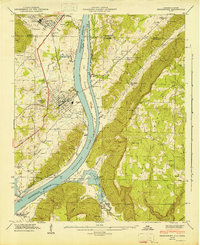
1946 Map of Bridgeport
USGS Topo · Published 1946About this map
The Tennessee River dominates this 1940s landscape, winding past the town of Bridgeport and under the heavy shadow of Sand Mountain. This survey illustrates the mid-century transition of the valley as the Guntersville Reservoir and its associated Guntersville Reservation defined new shorelines. The era's transportation network is clearly visible, from the tracks of the St Louis and Chattanooga RR to the crossing at Reese Ferry.
Find a feature on this map
57 named features on this map. Tap any name to fly to it.
Don’t see what you’re looking for? This feature index may not catch every label — zoom into the map to look around manually.
Map Details
Editions of this 1946 Bridgeport Map
2 editions found
Other maps of this area

1886 · Stevenson
USGS Topo · 1:125,000

1892 · Stevenson
USGS Topo · 1:125,000

1895 · Stevenson
USGS Topo · 1:125,000

1895 · Sewanee
USGS Topo · 1:125,000

1936 · Trenton
USGS Topo · 1:24,000

1936 · Shellmound
USGS Topo · 1:24,000

1936 · Orme
USGS Topo · 1:24,000

1936 · Bridgeport
USGS Topo · 1:24,000

1936 · Flat Rock
USGS Topo · 1:24,000

1936 · Stevenson
USGS Topo · 1:24,000