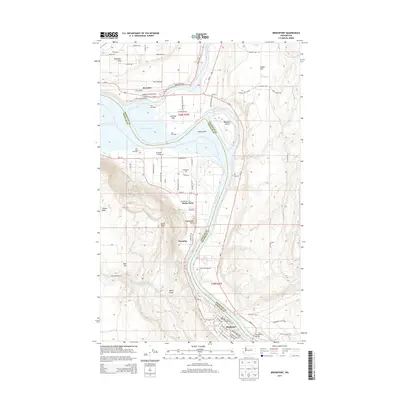
2014 Map of Bridgeport
USGS Topo · Published 2014About this map
Brewster and Bridgeport anchor this river-driven landscape where the Okanogan River meets the Columbia River at the boundary of Okanogan and Douglas counties. The map documents a region deeply shaped by its waterways and agricultural flats, notably Brewster Flat and the fertile Bridgeport Bar. Historic landmarks like Fort Okanogan and the Fort Okanogan Overlook point to the area's significance as a colonial-era trading post and transit hub long before modern infrastructure followed. The terrain rises sharply away from the riverbanks towards prominent heights like Rocky Butte and Castle Rock. Significant local infrastructure is present, including Anderson Field Airport and the Bridgeport Bridge, which connects the southern residential streets of Bridgeport to the larger valley. The map also highlights recreational and community spaces such as Bridgeport State Park and the Bridgeport Grange, illustrating the balance of industry and public land in north-central Washington.
Find a feature on this map
61 named features on this map. Tap any name to fly to it.
Don’t see what you’re looking for? This feature index may not catch every label — zoom into the map to look around manually.
Map Details
Editions of this 2014 Bridgeport Map
This is the sole edition of this map. No revisions or reprints were ever made.
Other maps of this area

1905 · Okanogan
USGS Topo · 1:125,000

1953 · Ritzville
USGS Topo · 1:250,000

1954 · Okanogan
USGS Topo · 1:250,000

1957 · Bridgeport
USGS Topo · 1:62,500

1957 · Brewster
USGS Topo · 1:62,500

1958 · Okanogan
USGS Topo · 1:250,000

1959 · Ritzville
USGS Topo · 1:250,000

1965 · Ritzville
USGS Topo · 1:250,000

1968 · Chief Joseph Dam
USGS Topo · 1:24,000

1968 · Wells Dam
USGS Topo · 1:24,000