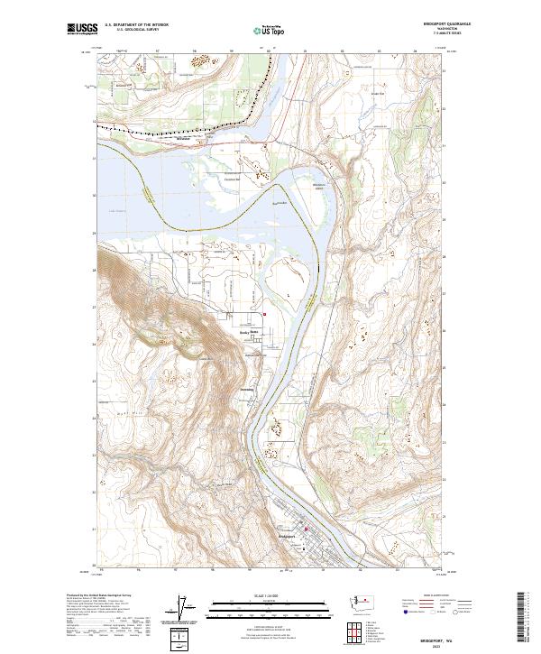
2023 Map of Bridgeport
USGS Topo · Published 2023About this map
The confluence of the Okanogan River and the Columbia River serves as the focal point for this survey, marking the jurisdictional boundary between Douglas Co and Okanogan Co. The terrain is characterized by broad alluvial features like Cassimer Bar, Buenna Bar, and Washburn Island, which sit just below the town of Brewster. Further south, the landscape rises toward the prominent heights of Rocky Butte and Devils Head, overlooking the more concentrated development of Bridgeport. This area reflects a long history of river-based commerce and agriculture, as evidenced by the extensive road network serving the Brewster Flat and Snider Flat areas. Genealogists will find the Bridgeport Cem and established settlements such as Downing useful for tracing local family history in this river valley corridor, while aviation history is represented by the location of Anderson Field.
Find a feature on this map
67 named features on this map. Tap any name to fly to it.
Don’t see what you’re looking for? This feature index may not catch every label — zoom into the map to look around manually.
Map Details
Editions of this 2023 Bridgeport Map
This is the sole edition of this map. No revisions or reprints were ever made.
Other maps of this area

1905 · Okanogan
USGS Topo · 1:125,000

1953 · Ritzville
USGS Topo · 1:250,000

1954 · Okanogan
USGS Topo · 1:250,000

1957 · Bridgeport
USGS Topo · 1:62,500

1957 · Brewster
USGS Topo · 1:62,500

1958 · Okanogan
USGS Topo · 1:250,000

1959 · Ritzville
USGS Topo · 1:250,000

1965 · Ritzville
USGS Topo · 1:250,000

1968 · Chief Joseph Dam
USGS Topo · 1:24,000

1968 · Wells Dam
USGS Topo · 1:24,000