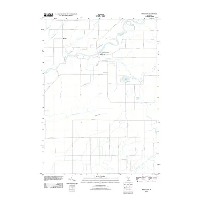
2011 Map of Bridgeton
USGS Topo · Published 2011About this map
The Muskegon River meanders through this portion of Newaygo County, anchoring the small settlement of Bridgeton and the northern community of McLean. The river's path is characterized by sharp bends and bluffs, such as W Bridgeton Blf, while several smaller tributaries like Minnie Creek and Graham Creek feed into its course. This area of Bridgeton Township exhibits a transition from the riparian environment of the Muskegon to the flatter, gridded agricultural and residential lands to the south.
Find a feature on this map
71 named features on this map. Tap any name to fly to it.
Don’t see what you’re looking for? This feature index may not catch every label — zoom into the map to look around manually.
Map Details
Editions of this 2011 Bridgeton Map
This is the sole edition of this map. No revisions or reprints were ever made.
Other maps of this area

1930 · Muskegon
USGS Topo · 1:62,500

1936 · Muskegon
USGS Topo · 1:62,500

1945 · Ravenna
USGS Topo · 1:62,500

1954 · Milwaukee
USGS Topo · 1:250,000

1954 · Midland
USGS Topo · 1:250,000

1958 · Midland
USGS Topo · 1:250,000

1958 · Milwaukee
USGS Topo · 1:250,000

1958 · Twin Lake
USGS Topo · 1:62,500

1958 · Fremont
USGS Topo · 1:62,500

1959 · Midland
USGS Topo · 1:250,000