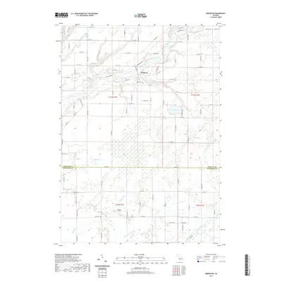
2019 Map of Bridgeton
USGS Topo · Published 2019About this map
Bridgeton occupies a prominent bend in the Muskegon River where the waterway carves through the local landscape, defined by elevated features like Bridgeton Bluff and Trillium Ridge. This area in Newaygo County is characterized by its complex drainage network, where numerous tributaries such as Brooks Cr, Graham Cr, and Mosquito Cr feed into the primary river valley. The map documents the rural distribution of properties and the Bridgeton Cem, serving as a primary point of interest for those tracking local family lineages. To the south, the terrain levels into a series of managed waterways like Slater Drain and Dailey Drain, illustrating how the land has been modified for agricultural use. Small water bodies like Sand Lake and Blood Lake dot the eastern portion of the quadrangle, connected by smaller streams like Indian Run and Sand Cr.
Find a feature on this map
88 named features on this map. Tap any name to fly to it.
Don’t see what you’re looking for? This feature index may not catch every label — zoom into the map to look around manually.
Map Details
Editions of this 2019 Bridgeton Map
This is the sole edition of this map. No revisions or reprints were ever made.
Other maps of this area

1930 · Muskegon
USGS Topo · 1:62,500

1936 · Muskegon
USGS Topo · 1:62,500

1945 · Ravenna
USGS Topo · 1:62,500

1954 · Milwaukee
USGS Topo · 1:250,000

1954 · Midland
USGS Topo · 1:250,000

1958 · Midland
USGS Topo · 1:250,000

1958 · Milwaukee
USGS Topo · 1:250,000

1958 · Twin Lake
USGS Topo · 1:62,500

1958 · Fremont
USGS Topo · 1:62,500

1959 · Midland
USGS Topo · 1:250,000