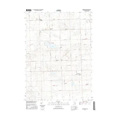
2017 Map of Bridgewater
USGS Topo · Published 2017About this map
Bridgewater and Rogers Corner anchor this Washtenaw County landscape, characterized by a dense distribution of rural burial grounds and glacial lakes. Numerous family and denominational sites such as Zion Lutheran Cem, Freedom Emanuel Evangelical Memorial Cem, and Saint Francis Catholic Cem are scattered across the township grid, reflecting the early settlement patterns of the region's diverse congregations. The terrain is marked by significant water bodies, including the central Pleasant Lake and Columbia Lake to the south, while the Saline River and River Raisin provide the primary drainage. The road network follows a rigid section-line system, with labels like Lima Center Rd and W Ellsworth Rd connecting these agrarian communities. This survey documents the intersection of 19th-century church and cemetery locations with the modern residential developments concentrated along the shorelines of the local lakes.
Find a feature on this map
72 named features on this map. Tap any name to fly to it.
Don’t see what you’re looking for? This feature index may not catch every label — zoom into the map to look around manually.
Map Details
Editions of this 2017 Bridgewater Map
This is the sole edition of this map. No revisions or reprints were ever made.
Other maps of this area

1902 · Dexter
USGS Topo · 1:62,500

1904 · Ann Arbor
USGS Topo · 1:125,000

1906 · Dexter
USGS Topo · 1:62,500

1906 · Saline
USGS Topo · 1:62,500

1908 · Ann Arbor
USGS Topo · 1:125,000

1919 · Stockbridge
USGS Topo · 1:62,500

1922 · Stockbridge
USGS Topo · 1:62,500

1942 · Stockbridge
USGS Topo · 1:62,500

1948 · Manchester
USGS Topo · 1:62,500

1949 · Manchester
USGS Topo · 1:62,500
Featured Places
- Lodi Township, MI
- Saline Township, MI
- Bridgewater, Bridgewater Township
- Bridgewater Township, MI
- Freedom Township, MI