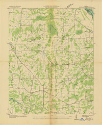
1936 Map of Briensburg
USGS Topo · Published 1936About this map
Briensburg and its surrounding rural townships sit at a crossroads of early transit and agriculture in western Kentucky during the mid-1930s. The landscape is defined by the Clarks River and the meandering Cypress Creek, where a network of drainage ditches illustrates efforts to manage the wet bottomlands for farming. This era shows the prominent path of the Jefferson Davis Highway, which serves as a primary artery connecting the small communities of Tatumsville and Palma.
Find a feature on this map
57 named features on this map. Tap any name to fly to it.
Don’t see what you’re looking for? This feature index may not catch every label — zoom into the map to look around manually.
Map Details
Editions of this 1936 Briensburg Map
This is the sole edition of this map. No revisions or reprints were ever made.
Other maps of this area

1928 · Eddyville
USGS Topo · 1:48,000

1929 · Smithland
USGS Topo · 1:62,500

1931 · Eddyville
USGS Topo · 1:62,500

1936 · Oak Level
USGS Topo · 1:24,000

1936 · Elva
USGS Topo · 1:24,000

1936 · Eddyville
USGS Topo · 1:48,000

1936 · Grand Rivers
USGS Topo · 1:24,000

1936 · Hardin
USGS Topo · 1:24,000

1936 · Smithland
USGS Topo · 1:48,000

1936 · Hiatt
USGS Topo · 1:24,000