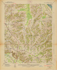
1938 Map of Briensburg
USGS Topo · Published 1938About this map
The Tennessee River corridor in Marshall County is captured here just before the massive landscape changes of the mid-20th century. At this time, the river is still identified as part of the OHIO RIVER POOL No. 52, with rural life centered on small inland settlements like Palma, Tatumsville, and Briensburg. The landscape is characterized by a dense network of country schools and family-named cemeteries, indicating a deeply rooted rural population. Educational sites such as Lone Valley School, Pugh Sch, and Stahl Sch are scattered across the terrain, serving local farming families.
Find a feature on this map
48 named features on this map. Tap any name to fly to it.
Don’t see what you’re looking for? This feature index may not catch every label — zoom into the map to look around manually.
Map Details
Editions of this 1938 Briensburg Map
This is the sole edition of this map. No revisions or reprints were ever made.
Other maps of this area

1928 · Eddyville
USGS Topo · 1:48,000

1929 · Smithland
USGS Topo · 1:62,500

1931 · Eddyville
USGS Topo · 1:62,500

1936 · Oak Level
USGS Topo · 1:24,000

1936 · Elva
USGS Topo · 1:24,000

1936 · Eddyville
USGS Topo · 1:48,000

1936 · Grand Rivers
USGS Topo · 1:24,000

1936 · Hardin
USGS Topo · 1:24,000

1936 · Smithland
USGS Topo · 1:48,000

1936 · Hiatt
USGS Topo · 1:24,000