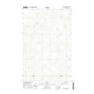
2014 Map of Bright Water Lake
USGS Topo · Published 2014About this map
Bright Water Lake sits as the central geographic landmark of this high plains region, surrounded by a precise grid of rural section roads. The landscape is defined by its agricultural organization, with the boundary between Divide Co and Williams Co running along 84th St NW at the southern edge of the map. This area of North Dakota is characterized by a sparse, systematic settlement pattern where primary transit is facilitated by routes like CR-11 and a network of numbered avenues and streets, including 130th Ave NW and 92nd St NW. The lack of dense town centers highlights the isolation and large-scale farming character of the northern prairie just after the first decade of the 2000s.
Find a feature on this map
19 named features on this map. Tap any name to fly to it.
Don’t see what you’re looking for? This feature index may not catch every label — zoom into the map to look around manually.
Map Details
Editions of this 2014 Bright Water Lake Map
This is the sole edition of this map. No revisions or reprints were ever made.
Other maps of this area

1948 · Smoky Butte
USGS Topo · 1:24,000

1948 · Alamo N.E.
USGS Topo · 1:24,000

1948 · Crosby SW
USGS Topo · 1:24,000

1948 · Bright Water Lake
USGS Topo · 1:24,000

1948 · Crosby SE
USGS Topo · 1:24,000

1950 · Crosby
USGS Topo · 1:62,500

1953 · Williston
USGS Topo · 1:250,000

1957 · Williston
USGS Topo · 1:250,000

1977 · Appam
USGS Topo · 1:24,000

1977 · Alamo
USGS Topo · 1:24,000