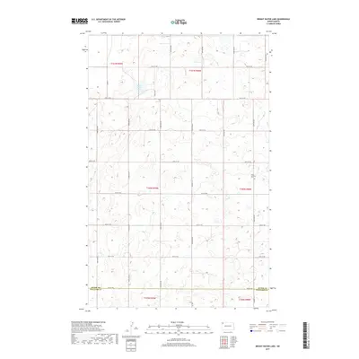
2017 Map of Bright Water Lake
USGS Topo · Published 2017About this map
Bright Water Lake centers this high-plains landscape in Williams County, surrounded by a complex network of wetlands and seasonal ponds. The topography is defined by the Section-Line roads of the Public Land Survey System, creating a distinct grid across the prairie. The lone community landmark of Skabo Lutheran Cem stands in the eastern portion of the quadrangle, serving as a significant site for genealogical research in this sparsely populated region. The southern edge of the map follows the Divide Co Williams Co boundary, marking the transition between jurisdictions. Modern transportation is facilitated by arterial routes like Co Rd 11 and Co Hwy 13, which connect the remote agricultural tracts and small water bodies that characterize this corner of North Dakota.
Find a feature on this map
27 named features on this map. Tap any name to fly to it.
Don’t see what you’re looking for? This feature index may not catch every label — zoom into the map to look around manually.
Map Details
Editions of this 2017 Bright Water Lake Map
This is the sole edition of this map. No revisions or reprints were ever made.
Other maps of this area

1948 · Smoky Butte
USGS Topo · 1:24,000

1948 · Alamo N.E.
USGS Topo · 1:24,000

1948 · Crosby SW
USGS Topo · 1:24,000

1948 · Bright Water Lake
USGS Topo · 1:24,000

1948 · Crosby SE
USGS Topo · 1:24,000

1950 · Crosby
USGS Topo · 1:62,500

1953 · Williston
USGS Topo · 1:250,000

1957 · Williston
USGS Topo · 1:250,000

1977 · Appam
USGS Topo · 1:24,000

1977 · Alamo
USGS Topo · 1:24,000