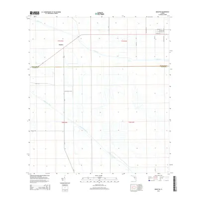
2015 Map of Brighton
USGS Topo · Published 2015About this map
The Brighton community and the surrounding agricultural landscape define this portion of South-Central Florida along the Highlands Co Glades Co line. The terrain is characterized by a sophisticated network of water management, primarily through the Canal C-41a and the Indian Prairie Canal, which facilitate drainage and irrigation across the flat expanse. Aviation history is noted by the presence of the Lykes Brighton Airport, situated near CR-721. The map reveals a grid of rural routes and dairy-related infrastructure, such as Sw Rucks Dairy Rd, reflecting the regional reliance on ranching and large-scale land management. Long-established tracks like Bullhead Grade and Peeples Rd underscore the persistent transport corridors used by local families and industry in this inland region.
Find a feature on this map
21 named features on this map. Tap any name to fly to it.
Don’t see what you’re looking for? This feature index may not catch every label — zoom into the map to look around manually.
Map Details
Editions of this 2015 Brighton Map
This is the sole edition of this map. No revisions or reprints were ever made.
Other maps of this area

1952 · Okeechobee NW
USGS Topo · 1:24,000

1953 · Brighton NW
USGS Topo · 1:24,000

1953 · Brighton SW
USGS Topo · 1:24,000

1953 · Fort Basinger
USGS Topo · 1:24,000

1953 · Brighton
USGS Topo · 1:24,000

1953 · Brighton SE
USGS Topo · 1:24,000

1953 · Okeechobee SW
USGS Topo · 1:24,000

1953 · Basinger SW
USGS Topo · 1:24,000

1953 · Taylor Creek SW
USGS Topo · 1:24,000

1956 · Fort Pierce
USGS Topo · 1:250,000