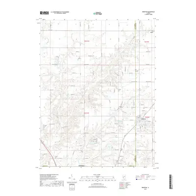
2018 Map of Brighton
USGS Topo · Published 2018About this map
Brighton and the northern edge of Godfrey anchor this Illinois landscape along the border of Jersey and Macoupin counties. The terrain is defined by the winding course of Piasa Creek and its many tributaries, such as Little Piasa Creek, which create a complex system of wooded draws and ridges between agricultural fields. Numerous small water bodies, including Crystal Lake, Gotter Pond, and Thunderbird Lake, are scattered throughout the region, reflecting a mix of natural drainages and modern impoundments.
Find a feature on this map
103 named features on this map. Tap any name to fly to it.
Don’t see what you’re looking for? This feature index may not catch every label — zoom into the map to look around manually.
Map Details
Editions of this 2018 Brighton Map
This is the sole edition of this map. No revisions or reprints were ever made.
Other maps of this area

1925 · Brighton
USGS Topo · 1:62,500

1927 · Alton
USGS Topo · 1:62,500

1927 · St. Charles
USGS Topo · 1:62,500

1928 · Brighton
USGS Topo · 1:62,500

1930 · Jerseyville
USGS Topo · 1:62,500

1933 · Jerseyville
USGS Topo · 1:62,500

1933 · Saint Charles
USGS Topo · 1:62,500

1934 · Alton
USGS Topo · 1:62,500

1948 · Quincy
USGS Topo · 1:250,000
1948 · Alton
USGS Topo · 1:24,000