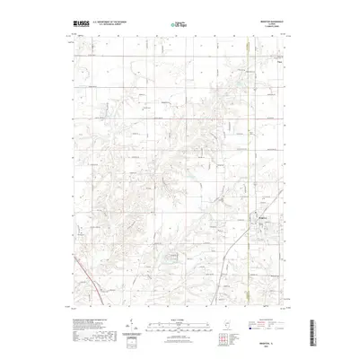
2021 Map of Brighton
USGS Topo · Published 2021About this map
The village of Brighton sits at the intersection of Macoupin and Jersey counties, anchoring a landscape defined by the intricate drainage of Piasa Creek and its various tributaries. This modern survey illustrates the persistent agricultural and residential character of the region, where numerous family and community burial grounds are meticulously documented. Genealogists will find a high density of sites including Brighton City Cem, Saint Alphonsus Cem, and Chapman Cem, reflecting generations of settlement along the local ridges. The terrain is notably marked by water management and recreation, featuring several named bodies of water such as Thunderbird Lake, Rowden Lake, and Briarwood Lake. The drainage network, particularly Little Piasa Creek, carves a complex topography through the countryside, influencing the placement of roads like Wagonblast Road and Miles Station Road.
Find a feature on this map
102 named features on this map. Tap any name to fly to it.
Don’t see what you’re looking for? This feature index may not catch every label — zoom into the map to look around manually.
Map Details
Editions of this 2021 Brighton Map
This is the sole edition of this map. No revisions or reprints were ever made.
Other maps of this area

1925 · Brighton
USGS Topo · 1:62,500

1927 · Alton
USGS Topo · 1:62,500

1927 · St. Charles
USGS Topo · 1:62,500

1928 · Brighton
USGS Topo · 1:62,500

1930 · Jerseyville
USGS Topo · 1:62,500

1933 · Jerseyville
USGS Topo · 1:62,500

1933 · Saint Charles
USGS Topo · 1:62,500

1934 · Alton
USGS Topo · 1:62,500

1948 · Quincy
USGS Topo · 1:250,000
1948 · Alton
USGS Topo · 1:24,000