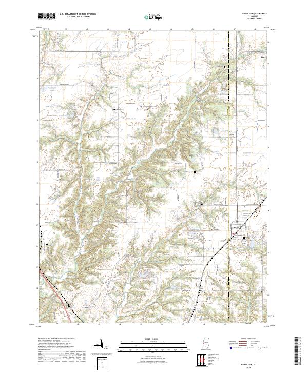
2024 Map of Brighton
USGS Topo · Published 2024About this map
The village of Brighton sits at the intersection of the Jersey Co and Macoupin Co line, serving as a focal point for this agrarian landscape in southwestern Illinois. This modern 2024 survey captures a region defined by scattered farmsteads and numerous family burial grounds, reflecting deep roots in the local community. Genealogists will find a high concentration of cemeteries including Brighton City Cem, Saint Alphonsus Cem, and Mount Pleasant Cem, often located near crossroads or traditional land boundaries.
Find a feature on this map
81 named features on this map. Tap any name to fly to it.
Don’t see what you’re looking for? This feature index may not catch every label — zoom into the map to look around manually.
Map Details
Editions of this 2024 Brighton Map
This is the sole edition of this map. No revisions or reprints were ever made.
Other maps of this area

1925 · Brighton
USGS Topo · 1:62,500

1927 · Alton
USGS Topo · 1:62,500

1927 · St. Charles
USGS Topo · 1:62,500

1928 · Brighton
USGS Topo · 1:62,500

1930 · Jerseyville
USGS Topo · 1:62,500

1933 · Jerseyville
USGS Topo · 1:62,500

1933 · Saint Charles
USGS Topo · 1:62,500

1934 · Alton
USGS Topo · 1:62,500

1948 · Quincy
USGS Topo · 1:250,000
1948 · Alton
USGS Topo · 1:24,000