
1911 Map of Brighton
USGS Topo · Published 1911About this map
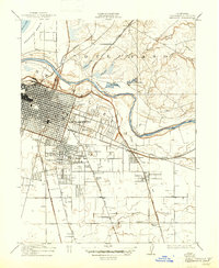
Sacramento expands eastward from the American River in this detailed 1911 survey, showing a landscape defined by an emerging urban grid and the lingering sloughs of the valley floor. The map highlights the historic New Helvetia grant area and the established neighborhoods of Oak Park and Highland Park. Beyond the city limits, the terrain transitions into the ranch lands of Del Paso, where drainage features like Chicken Ranch Slough and Strong Ranch Slough carve through the basin.
Find a feature on this map
37 named features on this map. Tap any name to fly to it.
Don’t see what you’re looking for? This feature index may not catch every label — zoom into the map to look around manually.
Map Details
Editions of this 1911 Brighton Map
2 editions found
Other maps of this area

1891 · Sacramento
USGS Topo · 1:125,000

1892 · Sacramento
USGS Topo · 1:125,000

1893 · Sacramento
USGS Topo · 1:125,000

1894 · Lodi
USGS Topo · 1:125,000

1902 · Fairoaks
USGS Topo · 1:62,500

1907 · Davisville
USGS Topo · 1:62,500

1908 · Courtland
USGS Topo · 1:62,500

1909 · Elk Grove
USGS Topo · 1:31,680

1909 · Florin
USGS Topo · 1:31,680

1911 · Mills
USGS Topo · 1:31,680