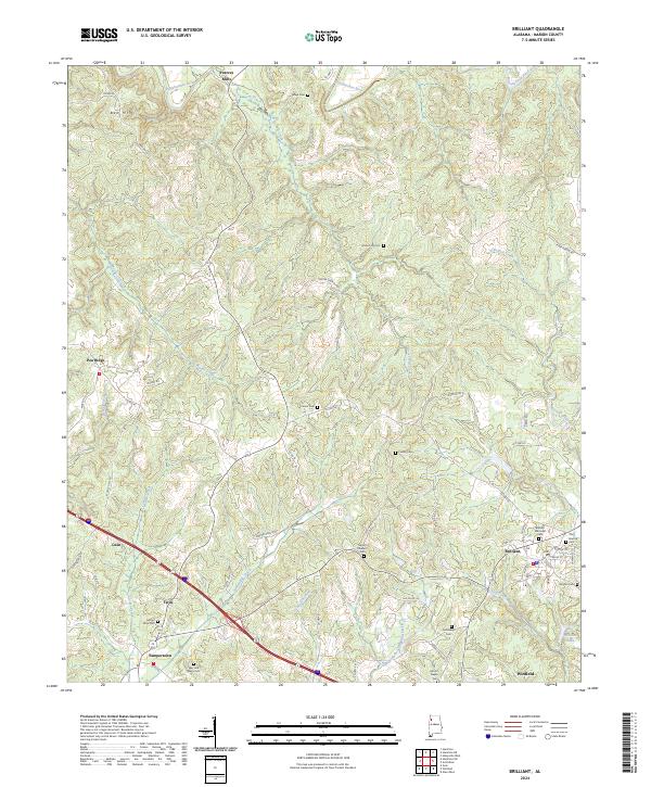
2024 Map of Brilliant
USGS Topo · Published 2024About this map
Brilliant serves as the focal point for this Marion County region, situated where Clifty Creek and Bostick Creek converge near the local waters of Brilliant Lake. The settlement pattern reflects a cluster of small communities and rural family sites, including Yampertown, Twin, and the higher ground at Pea Ridge. To the north, the Buttahatchee River winds through the landscape near Pearces Mills, while the southern reaches are defined by the East Branch Luxapallila Creek near Winfield.
Find a feature on this map
69 named features on this map. Tap any name to fly to it.
Don’t see what you’re looking for? This feature index may not catch every label — zoom into the map to look around manually.
Map Details
Editions of this 2024 Brilliant Map
This is the sole edition of this map. No revisions or reprints were ever made.
Other maps of this area

1936 · South Of Hackleburg
USGS Topo · 1:24,000

1936 · Goddard
USGS Topo · 1:24,000

1953 · Birmingham
USGS Topo · 1:250,000

1956 · Birmingham
USGS Topo · 1:250,000

1956 · Gadsden
USGS Topo · 1:250,000

1957 · Birmingham
USGS Topo · 1:250,000

1958 · Gadsden
USGS Topo · 1:250,000
1958 · Haleyville West
USGS Topo · 1:24,000

1958 · Gold Mine
USGS Topo · 1:24,000

1960 · Gadsden
USGS Topo · 1:250,000