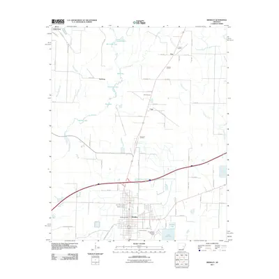
2011 Map of Brinkley
USGS Topo · Published 2011About this map
Brinkley serves as the primary hub on this eastern Arkansas survey, situated amidst a landscape defined by expansive water bodies and agricultural drainage. The city's layout is documented in detail, including the Brinkley Post Office and the Frank Federer Memorial Airport to the southeast. Outside the city limits, the terrain is shaped by the winding course of Bayou De View and numerous local lakes such as Section 16 Lake, Mill Lake, and Lake Greenlee. For genealogists, the map identifies several local burial grounds, including Haven Rest Cemetery, Oaklawn Cemetery, and Calvary Cemetery. Moving north, smaller settlements like Fargo, Zent, and Saulsburg appear along the road and rail corridors, while family names like Munn Cemetery and Henard Cemetery indicate long-standing ties to the rural landscape.
Find a feature on this map
75 named features on this map. Tap any name to fly to it.
Don’t see what you’re looking for? This feature index may not catch every label — zoom into the map to look around manually.
Map Details
Editions of this 2011 Brinkley Map
This is the sole edition of this map. No revisions or reprints were ever made.
Other maps of this area

1935 · Gregory
USGS Topo · 1:62,500

1939 · Hunter
USGS Topo · 1:62,500

1940 · Brinkley
USGS Topo · 1:62,500

1941 · De Valls Bluff
USGS Topo · 1:62,500

1948 · Helena
USGS Topo · 1:250,000

1950 · Helena
USGS Topo · 1:250,000

1953 · Memphis
USGS Topo · 1:250,000

1955 · Helena
USGS Topo · 1:250,000

1956 · Memphis
USGS Topo · 1:250,000

1956 · Hunter
USGS Topo · 1:62,500