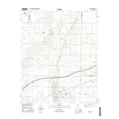
2017 Map of Brinkley
USGS Topo · Published 2017About this map
Brinkley serves as a primary hub in Monroe County, defined by a dense grid of residential streets and its proximity to Lake Greenlee. This landscape is heavily shaped by the sluggish waters of Bayou De View, which winds through the northern half of the region, creating a series of cypress-lined water bodies like Big Cotton Lake and Little Cotton Lake. The agricultural character of the era is evident in the scattered small settlements of Cotton Plant, Wheatley, and Fargo, which are connected by a network of rural routes such as Zent Rd and Turner Rd. Genealogists will find several burial grounds documented across the territory, including Macedonia Cem, Anderson Cem, and Oaklawn Cem. To the south, the Frank Federer Memorial Airport marks a modern transport node adjacent to the established town center.
Find a feature on this map
74 named features on this map. Tap any name to fly to it.
Don’t see what you’re looking for? This feature index may not catch every label — zoom into the map to look around manually.
Map Details
Editions of this 2017 Brinkley Map
This is the sole edition of this map. No revisions or reprints were ever made.
Other maps of this area

1935 · Gregory
USGS Topo · 1:62,500

1939 · Hunter
USGS Topo · 1:62,500

1940 · Brinkley
USGS Topo · 1:62,500

1941 · De Valls Bluff
USGS Topo · 1:62,500

1948 · Helena
USGS Topo · 1:250,000

1950 · Helena
USGS Topo · 1:250,000

1953 · Memphis
USGS Topo · 1:250,000

1955 · Helena
USGS Topo · 1:250,000

1956 · Memphis
USGS Topo · 1:250,000

1956 · Hunter
USGS Topo · 1:62,500