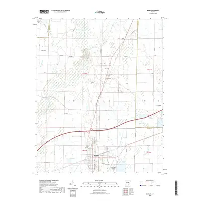
2020 Map of Brinkley
USGS Topo · Published 2020About this map
Brinkley serves as the focal point of this Eastern Arkansas landscape, situated at a crossroads of commerce and transportation. The town's grid extends toward Lake Greenlee and Brinkley Lake, while the Frank Federer Memorial Airport marks the southern periphery. To the north, the terrain transitions into a mosaic of wetlands and agricultural tracts defined by Bayou de View and its associated Bayou De View Water Trail. The map documents a network of small settlements and named corners, such as Fargo, Wheatley, and Fox'S Corner, which developed along historical transit corridors. Local genealogy is well-represented through several family and community burial sites, including Macedonia Cem, Munn Cem, and Ash Grove Cem. The presence of features like Maple Slough and Caney Slash illustrates the persistent hydrology of the Mississippi Delta, where drainage patterns and bayous continue to shape the placement of roads like Railroad RD and Co Line RD.
Find a feature on this map
95 named features on this map. Tap any name to fly to it.
Don’t see what you’re looking for? This feature index may not catch every label — zoom into the map to look around manually.
Map Details
Editions of this 2020 Brinkley Map
This is the sole edition of this map. No revisions or reprints were ever made.
Other maps of this area

1935 · Gregory
USGS Topo · 1:62,500

1939 · Hunter
USGS Topo · 1:62,500

1940 · Brinkley
USGS Topo · 1:62,500

1941 · De Valls Bluff
USGS Topo · 1:62,500

1948 · Helena
USGS Topo · 1:250,000

1950 · Helena
USGS Topo · 1:250,000

1953 · Memphis
USGS Topo · 1:250,000

1955 · Helena
USGS Topo · 1:250,000

1956 · Memphis
USGS Topo · 1:250,000

1956 · Hunter
USGS Topo · 1:62,500