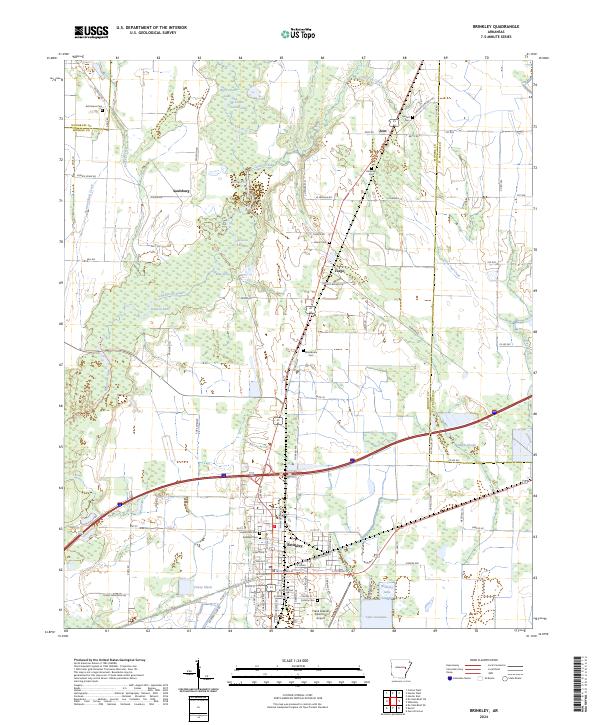
2024 Map of Brinkley
USGS Topo · Published 2024About this map
The low-lying wetlands of the Cache River National Wildlife Refuge dominate the western half of this Arkansas landscape, where complex water systems like Bayou De View and Benson Slash Creek define the local geography. The city of Brinkley serves as the regional anchor at the intersection of major rail and road corridors, surrounded by several smaller historic communities such as Fargo, Zent, and Saulsburg. The map reveals a dense network of cemeteries, including Oaklawn Cem, Haven Rest Cem, and Calvary Cem, providing critical anchor points for genealogical research in Monroe County. Beyond the town centers, the landscape is a patchwork of agriculture and swamp, punctuated by landmarks like the Frank Federer Memorial Airport and the managed waters of Lake Greenlee and Brinkley Lake.
Find a feature on this map
97 named features on this map. Tap any name to fly to it.
Don’t see what you’re looking for? This feature index may not catch every label — zoom into the map to look around manually.
Map Details
Editions of this 2024 Brinkley Map
This is the sole edition of this map. No revisions or reprints were ever made.
Other maps of this area

1935 · Gregory
USGS Topo · 1:62,500

1939 · Hunter
USGS Topo · 1:62,500

1940 · Brinkley
USGS Topo · 1:62,500

1941 · De Valls Bluff
USGS Topo · 1:62,500

1948 · Helena
USGS Topo · 1:250,000

1950 · Helena
USGS Topo · 1:250,000

1953 · Memphis
USGS Topo · 1:250,000

1955 · Helena
USGS Topo · 1:250,000

1956 · Memphis
USGS Topo · 1:250,000

1956 · Hunter
USGS Topo · 1:62,500