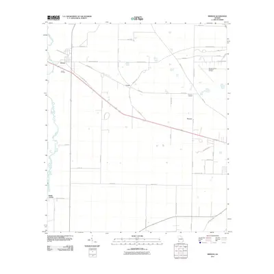
2011 Map of Brinson
USGS Topo · Published 2011About this map
Spring Creek meanders along the western edge of this Decatur County landscape, defining the local topography near the settlement of Brinson. The area is characterized by a grid of rural roads and agricultural plots, punctuated by small community hubs such as Cyrene and Hanover. Local history is preserved in the Jackson Cemetery and Thompson Cemetery, which serve as quiet landmarks for genealogists tracing family roots in this corner of Georgia. To the northeast, the Decatur County Industrial Air Park and infrastructure like Brinson Air Base Rd indicate the region's twentieth-century evolution from pure agriculture to industrial and aviation utility. The network of family-named routes, including John Sam Rd and Bennett Rentz Rd, reflects a deeply rooted community structure where land ownership and local travel ways have remained intertwined over generations.
Find a feature on this map
45 named features on this map. Tap any name to fly to it.
Don’t see what you’re looking for? This feature index may not catch every label — zoom into the map to look around manually.
Map Details
Editions of this 2011 Brinson Map
This is the sole edition of this map. No revisions or reprints were ever made.
Other maps of this area

1953 · Dothan
USGS Topo · 1:250,000

1954 · Dothan
USGS Topo · 1:250,000

1954 · Desser
USGS Topo · 1:24,000

1954 · Tallahassee
USGS Topo · 1:250,000

1955 · Dothan
USGS Topo · 1:250,000

1955 · Reynoldsville
USGS Topo · 1:24,000

1955 · Bainbridge
USGS Topo · 1:62,500

1959 · Tallahassee
USGS Topo · 1:250,000

1960 · Tallahassee
USGS Topo · 1:250,000

1974 · Boykin
USGS Topo · 1:24,000