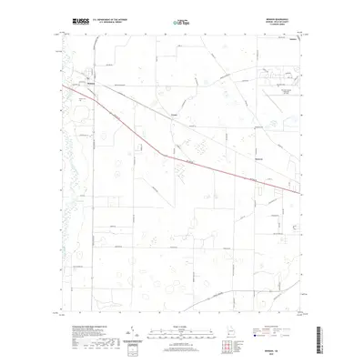
2020 Map of Brinson
USGS Topo · Published 2020About this map
Brinson serves as the primary hub in this Georgia landscape, situated where Brinson Colquitt Rd meets several local thoroughfares. The terrain is defined by the winding course of Spring Creek along the western edge, a waterway that feeds into Yates Springs. This region shows a shift from traditional agricultural settlements to modern infrastructure, evidenced by the presence of the Decatur County Industrial Air Park in the northeast. Small, historic communities such as Cyrene, Hanover, and Ausmac are scattered throughout the quadrangle, connected by a network of rural routes like Dothan Rd and Old Bainbridge Rd. For those tracing local heritage, the map identifies family-named landmarks and burial sites, including Jackson Cem near the main town and Thompson Cem further east, reflecting the deep-rooted settlement patterns of Decatur County.
Find a feature on this map
63 named features on this map. Tap any name to fly to it.
Don’t see what you’re looking for? This feature index may not catch every label — zoom into the map to look around manually.
Map Details
Editions of this 2020 Brinson Map
This is the sole edition of this map. No revisions or reprints were ever made.
Other maps of this area

1953 · Dothan
USGS Topo · 1:250,000

1954 · Dothan
USGS Topo · 1:250,000

1954 · Desser
USGS Topo · 1:24,000

1954 · Tallahassee
USGS Topo · 1:250,000

1955 · Dothan
USGS Topo · 1:250,000

1955 · Reynoldsville
USGS Topo · 1:24,000

1955 · Bainbridge
USGS Topo · 1:62,500

1959 · Tallahassee
USGS Topo · 1:250,000

1960 · Tallahassee
USGS Topo · 1:250,000

1974 · Boykin
USGS Topo · 1:24,000