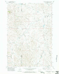
1972 Map of Brislawn School
USGS Topo · Published 1975About this map
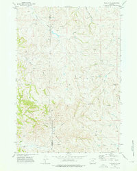
Campbell and Crook County border lands are defined by a high-plains landscape of erosion and industry in the early 1970s. The northern reaches are shaped by the Duck Creek Breaks and the waters of Edgerton Reservoir, while the southern terrain is marked by the branching drainages of Prairie Creek and its Short Prong. The map captures a transition in land use, where traditional ranching landmarks like Heald and Bertha sit alongside a modern network of pipelines and numerous exploratory drill holes. A concentration of gravel extraction and resource survey points highlights the mid-century industrial expansion into this rural landscape. The namesake Brislawn Sch serves as a primary local landmark in the southeastern corner, anchoring a region otherwise dominated by long, winding coulees such as Canoy Draw and Anderson Draw.
Find a feature on this map
20 named features on this map. Tap any name to fly to it.
Don’t see what you’re looking for? This feature index may not catch every label — zoom into the map to look around manually.
Map Details
Editions of this 1972 Brislawn School Map
2 editions found
Other maps of this area

1905 · Devils Tower
USGS Topo · 1:125,000

1954 · Gillette
USGS Topo · 1:250,000

1955 · Gillette
USGS Topo · 1:250,000

1957 · Oshoto
USGS Topo · 1:62,500

1957 · Cedar Ridge
USGS Topo · 1:62,500

1958 · Gillette
USGS Topo · 1:250,000

1962 · Gillette
USGS Topo · 1:250,000
1972 · Bonnie Reservoir
USGS Topo · 1:24,000
1972 · Bowman Hill
USGS Topo · 1:24,000
1972 · Flag Butte
USGS Topo · 1:24,000