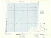
1967 Map of Bristol Bay
USGS Topo · Published 1967About this map
Bristol Bay dominates this coastal survey, where the Alaska Peninsula shoreline is defined by shifting sediments and isolated outposts. Based on data from the U.S. Geological Survey and the Army Map Service, the map records a sparsely populated maritime landscape during the mid-1960s. The coastline near the mouth of the Cinder River is marked by extensive Tidal Flats and Mud banks, indicating a treacherous and ever-changing littoral environment. Inland, a series of small named locations such as Tugg, Quinn, Teck, and Babs suggests a network of seasonal camps, surveyor benchmarks, or remote cabins rather than established towns. The presence of Hook Lagoon and a singular Cabin near the shore highlights the reliance on protected waterways for navigation and shelter in this part of the Lake and Peninsula region.
Find a feature on this map
12 named features on this map. Tap any name to fly to it.
Don’t see what you’re looking for? This feature index may not catch every label — zoom into the map to look around manually.
Map Details
Editions of this 1967 Bristol Bay Map
This is the sole edition of this map. No revisions or reprints were ever made.
Other maps of this area

1943 · Ugashik
USGS Topo · 1:250,000

1945 · Nushagak Bay
USGS Topo · 1:250,000

1948 · Ugashik
USGS Topo · 1:250,000

1949 · Ugashik
USGS Topo · 1:250,000

1949 · Nushagak Bay
USGS Topo · 1:250,000

1951 · Bristol Bay
USGS Topo · 1:250,000

1951 · Sutwik Island
USGS Topo · 1:250,000

1951 · Hagemeister Island
USGS Topo · 1:250,000

1951 · Nushagak Bay
USGS Topo · 1:250,000

1951 · Ugashik C-6
USGS Topo · 1:63,360