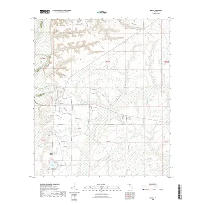
2018 Map of Bristol
USGS Topo · Published 2018About this map
The Apalachicola River defines the western edge of this landscape, carving past the dramatic heights of Alum Bluff before reaching the settlement of Bristol. The town's layout is centered near the intersection of Co Rte 67 and Co Rte 270, serving as a gateway to the dense network of creeks and branches that drain Liberty County. To the south, Lake Mystic and Outside Lake sit amidst a low-lying terrain characterized by Mud Swamp, illustrating the hydrological complexity of the Panhandle. Genealogists and local researchers can identify significant community landmarks like the Bristol Cem and Mitchum Cem, as well as the small community at White Springs. The map details numerous named watercourses such as Telogia Cr and Big Sweetwater Cr, which shaped the early settlement patterns and rural life in this river-oriented region.
Find a feature on this map
93 named features on this map. Tap any name to fly to it.
Don’t see what you’re looking for? This feature index may not catch every label — zoom into the map to look around manually.
Map Details
Editions of this 2018 Bristol Map
This is the sole edition of this map. No revisions or reprints were ever made.
Other maps of this area

1945 · Blountstown
USGS Topo · 1:31,680

1945 · Hosford
USGS Topo · 1:31,680

1945 · Estiffanulga
USGS Topo · 1:31,680

1945 · Bristol
USGS Topo · 1:31,680

1945 · Woods
USGS Topo · 1:31,680

1945 · Telogia
USGS Topo · 1:24,000

1946 · Telogia
USGS Topo · 1:31,680

1952 · Altha East
USGS Topo · 1:24,000

1954 · Tallahassee
USGS Topo · 1:250,000

1955 · Rock Bluff
USGS Topo · 1:24,000