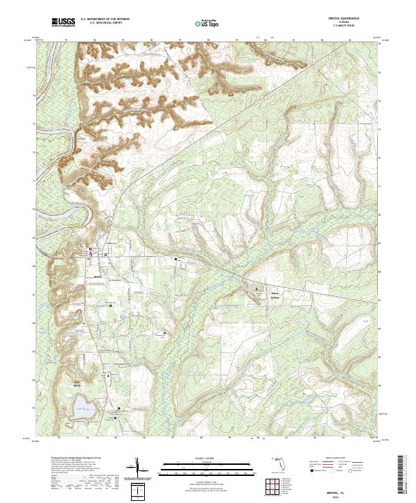
2024 Map of Bristol
USGS Topo · Published 2024About this map
The Apalachicola River flows along the western edge of this region, defined by the prominent Alum Bluff and a network of creeks like Big Sweetwater Creek and Telogia Creek. As the county seat of Liberty County, Bristol serves as the central hub, anchored by the Liberty County Courthouse. The map reveals a deeply rooted community structure, with numerous family and church-affiliated burial grounds scattered throughout the landscape, including the Anders Family Cem, Gregory Neil Gentry Cem, and More Abundant Church Cem. To the south, the settlement of Mystic sits near the shores of Lake Mystic, while the eastern portion of the map transition into the protected lands of the Apalachicola National Forest. Recreational trails such as the Florida National Scenic Trl and the Apalachicola River Blueway Trl follow the river's path, tracing the natural contours of the bluffs and ravines.
Find a feature on this map
101 named features on this map. Tap any name to fly to it.
Don’t see what you’re looking for? This feature index may not catch every label — zoom into the map to look around manually.
Map Details
Editions of this 2024 Bristol Map
This is the sole edition of this map. No revisions or reprints were ever made.
Other maps of this area

1945 · Blountstown
USGS Topo · 1:31,680

1945 · Hosford
USGS Topo · 1:31,680

1945 · Estiffanulga
USGS Topo · 1:31,680

1945 · Bristol
USGS Topo · 1:31,680

1945 · Woods
USGS Topo · 1:31,680

1945 · Telogia
USGS Topo · 1:24,000

1946 · Telogia
USGS Topo · 1:31,680

1952 · Altha East
USGS Topo · 1:24,000

1954 · Tallahassee
USGS Topo · 1:250,000

1955 · Rock Bluff
USGS Topo · 1:24,000