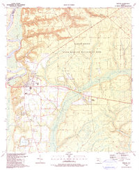
1990 Map of Bristol
USGS Topo · Published 1990About this map
Bristol serves as the focal point of this Northwest Florida survey, situated along the eastern banks of the Apalachicola River. The town's layout is well-defined, featuring civic markers such as the High Sch and Bristol Sch, alongside religious landmarks like Victory Temple and St Luke Ch. To the north, the landscape rises toward Alum Bluff, while much of the eastern terrain is dominated by the Robert Brent State Wildlife Management Area.
Find a feature on this map
42 named features on this map. Tap any name to fly to it.
Don’t see what you’re looking for? This feature index may not catch every label — zoom into the map to look around manually.
Map Details
Editions of this 1990 Bristol Map
This is the sole edition of this map. No revisions or reprints were ever made.
Other maps of this area

1945 · Blountstown
USGS Topo · 1:31,680

1945 · Hosford
USGS Topo · 1:31,680

1945 · Estiffanulga
USGS Topo · 1:31,680

1945 · Bristol
USGS Topo · 1:31,680

1945 · Woods
USGS Topo · 1:31,680

1945 · Telogia
USGS Topo · 1:24,000

1946 · Telogia
USGS Topo · 1:31,680

1952 · Altha East
USGS Topo · 1:24,000

1954 · Tallahassee
USGS Topo · 1:250,000

1955 · Rock Bluff
USGS Topo · 1:24,000