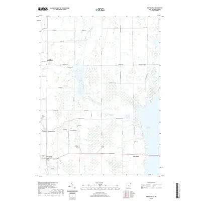
2019 Map of Bristolville
USGS Topo · Published 2019About this map
Mosquito Creek Lake dominates the eastern half of this Trumbull County landscape, a massive reservoir that altered the drainage of Mosquito Creek and its surrounding wetlands. The map reveals a countryside defined by deep-rooted family legacy, marked by numerous small burial grounds such as Sager Memorial Cem, Latimer Cem, and the Old Bristol Cem. Small crossroads settlements like North Bloomfield, Lockwood, and Bristolville anchor a network of township and county roads that cut through extensive marshy terrain.
Find a feature on this map
47 named features on this map. Tap any name to fly to it.
Don’t see what you’re looking for? This feature index may not catch every label — zoom into the map to look around manually.
Map Details
Editions of this 2019 Bristolville Map
This is the sole edition of this map. No revisions or reprints were ever made.
Other maps of this area

1905 · Andover
USGS Topo · 1:48,000

1905 · Bristolville
USGS Topo · 1:62,500

1905 · Jefferson
USGS Topo · 1:62,500

1907 · Andover
USGS Topo · 1:62,500

1907 · Kinsman
USGS Topo · 1:62,500

1907 · Bristolville
USGS Topo · 1:62,500

1907 · Jefferson
USGS Topo · 1:62,500

1950 · Cleveland
USGS Topo · 1:250,000

1952 · West Farmington
USGS Topo · 1:24,000

1952 · Southington
USGS Topo · 1:24,000
Featured Places
- Bristol, Bristol Township
- Mecca Township, OH
- Bloomfield, Bloomfield Township
- Bloomfield Township, OH
- Greene, Greene Township