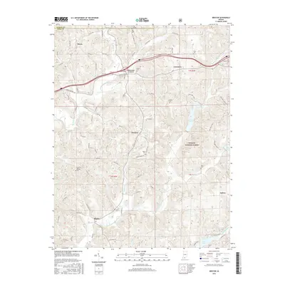
2016 Map of Bristow
USGS Topo · Published 2016About this map
The Middle Fork Anderson River and its numerous tributaries, including Sigler Cr, Tige Cr, and Sulphur Fork Cr, define the drainage patterns of this Perry County landscape. Within the protected boundaries of the Hoosier National Forest, several recreational water bodies are prominent, such as Tipsaw Lake, Lake Celina, and Indian Lake. The map reveals a high density of small family and community burial grounds, which are vital for genealogical research in this part of Indiana. Notable examples include the Fox Ridge Cem near the northern border, Underhill Cem, and the Mount Pleasant Cem. Settlements like Bristow, Sassafras, Siberia, and Uniontown are connected by a network of rural roads such as Bristow Rd and S Indian Lake Rd, while the Tipsaw Trail 1 and Two Lakes Trail suggest the area's modern use for outdoor recreation.
Find a feature on this map
89 named features on this map. Tap any name to fly to it.
Don’t see what you’re looking for? This feature index may not catch every label — zoom into the map to look around manually.
Map Details
Editions of this 2016 Bristow Map
This is the sole edition of this map. No revisions or reprints were ever made.
Other maps of this area

1900 · St Meinrad
USGS Topo · 1:62,500

1903 · St. Meinrad
USGS Topo · 1:62,500

1954 · Derby
USGS Topo · 1:24,000

1955 · Saint Anthony
USGS Topo · 1:24,000

1956 · Taswell
USGS Topo · 1:24,000

1956 · Vincennes
USGS Topo · 1:250,000

1957 · Vincennes
USGS Topo · 1:250,000

1957 · Birdseye
USGS Topo · 1:24,000
1957 · Bristow
USGS Topo · 1:24,000

1958 · Vincennes
USGS Topo · 1:250,000