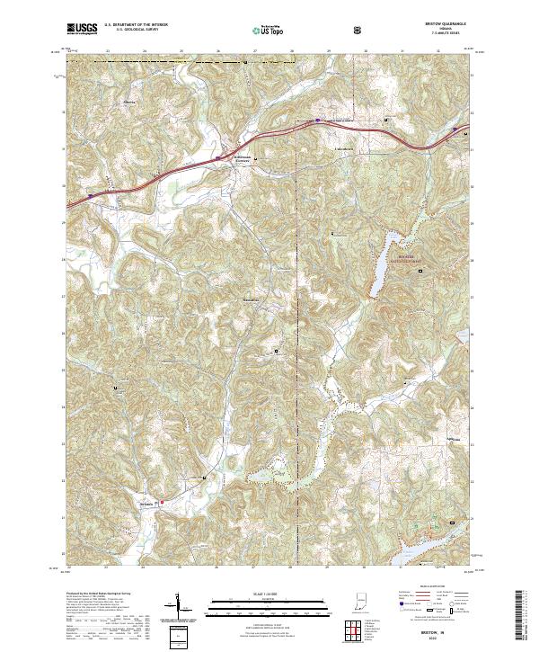
2022 Map of Bristow
USGS Topo · Published 2022About this map
Bristow sits at the heart of this Perry County landscape, where the drainage of the Middle Fork Anderson River and its numerous tributaries like Winding Br and Coon Br define the local topography. This southern Indiana region is characterized by small, dispersed rural settlements and a significant concentration of public land within the Hoosier National Forest. The map reveals a dense network of family-named landmarks and resting places, including the Beard Cem, Lasher Cem, and Hobbs Cem, which offer essential data points for local genealogical research.
Find a feature on this map
91 named features on this map. Tap any name to fly to it.
Don’t see what you’re looking for? This feature index may not catch every label — zoom into the map to look around manually.
Map Details
Editions of this 2022 Bristow Map
This is the sole edition of this map. No revisions or reprints were ever made.
Other maps of this area

1900 · St Meinrad
USGS Topo · 1:62,500

1903 · St. Meinrad
USGS Topo · 1:62,500

1954 · Derby
USGS Topo · 1:24,000

1955 · Saint Anthony
USGS Topo · 1:24,000

1956 · Taswell
USGS Topo · 1:24,000

1956 · Vincennes
USGS Topo · 1:250,000

1957 · Vincennes
USGS Topo · 1:250,000

1957 · Birdseye
USGS Topo · 1:24,000
1957 · Bristow
USGS Topo · 1:24,000

1958 · Vincennes
USGS Topo · 1:250,000