1951 Map of Britt
USGS Topo · Published 1971About this map
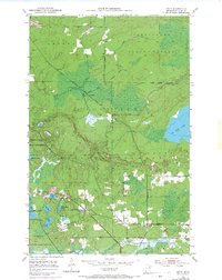
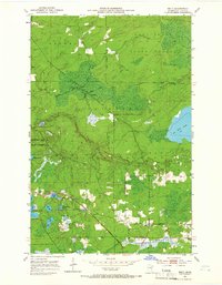
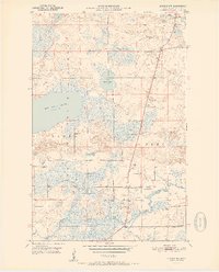
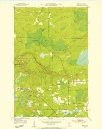
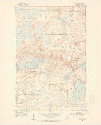
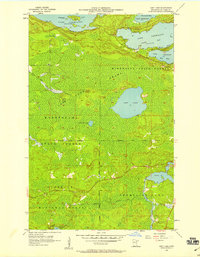
Big Rice Lake and the winding course of the Rice River dominate this pocket of St. Louis County, where the infrastructure of the Duluth Winnipeg and Pacific railroad dictates the local geography. Published in the early 1970s but based on earlier mid-century fieldwork, this survey captures the small community of Britt, including the Britt Post Office and nearby Sandy Cemetery. The landscape is a complex network of wetlands and small lakes, such as Wagon Wheel Lake and Jammer Lake, situated within the larger boundaries of the Superior National Forest and Kabetogama State Forest. Evidence of regional administration and resource management is visible through the presence of the Ranger Headquarters and the Town Hall. Notable 1969 aerial revisions highlight shifting road patterns and water levels near New Richmond Lake, reflecting the area's evolving role as a hub for both forestry and quiet lakeside settlement.
Find a feature on this map
30 named features on this map. Tap any name to fly to it.
Don’t see what you’re looking for? This feature index may not catch every label — zoom into the map to look around manually.
Map Details
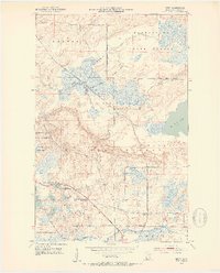
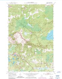
Editions of this 1951 Britt Map
5 editions found
Other maps of this area
1950 · Mc Kinley
USGS Topo · 1:24,000

1950 · Biwabik NW
USGS Topo · 1:24,000

1951 · Mc Kinley
USGS Topo · 1:24,000
1951 · Biwabik NW
USGS Topo · 1:24,000
1951 · Virginia
USGS Topo · 1:24,000
1951 · Kinney
USGS Topo · 1:24,000
1951 · Britt
USGS Topo · 1:24,000
1952 · Idington
USGS Topo · 1:24,000

1954 · Hibbing
USGS Topo · 1:250,000
1956 · Lost Lake
USGS Topo · 1:24,000