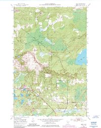
1951 Map of Britt
USGS Topo · Published 1985About this map
Sturgeon River State Forest and Superior National Forest define this mid-century landscape in St. Louis County, where public lands meet the industrial infrastructure of the Iron Range. The Duluth Winnipeg and Pacific railroad cuts through the terrain, serving the small community at Britt, which features the Britt P.O. and a Town Hall. This era was marked by a complex network of waterways and marshlands, notably the massive Big Rice Lake and the winding Rice River.
Find a feature on this map
25 named features on this map. Tap any name to fly to it.
Don’t see what you’re looking for? This feature index may not catch every label — zoom into the map to look around manually.
Map Details
Editions of this 1951 Britt Map
5 editions found
Other maps of this area

1950 · Mc Kinley
USGS Topo · 1:24,000

1950 · Biwabik NW
USGS Topo · 1:24,000

1951 · Mc Kinley
USGS Topo · 1:24,000

1951 · Biwabik NW
USGS Topo · 1:24,000

1951 · Virginia
USGS Topo · 1:24,000

1951 · Kinney
USGS Topo · 1:24,000

1951 · Britt
USGS Topo · 1:24,000

1952 · Idington
USGS Topo · 1:24,000

1954 · Hibbing
USGS Topo · 1:250,000

1956 · Lost Lake
USGS Topo · 1:24,000