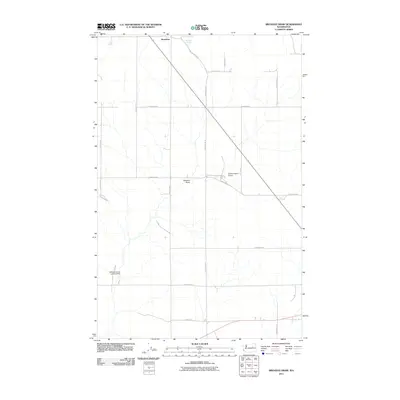
2011 Map of Broadax Draw
USGS Topo · Published 2011About this map
Hesseltine sits at the northern edge of this high-plateau landscape, where the agricultural grid is defined by long, straight roads that trace the section lines of Lincoln County. The terrain is notably marked by Broadax Draw, a natural depression that cuts through the center of the sheet, providing a geographic anchor for the eponymous Broadax Spring. This 2011 survey captures a rural environment where private aviation supports large-scale ranching operations, evidenced by the Sheffels Ranch Airport and the Williams Grove Landing Strip. The road network, including Hesseltine Rd N and Scheibner Rd N, highlights the persistent importance of family-named thoroughfares in maintaining the connectivity of this wheat-growing region south of the Grand Coulee area.
Find a feature on this map
22 named features on this map. Tap any name to fly to it.
Don’t see what you’re looking for? This feature index may not catch every label — zoom into the map to look around manually.
Map Details
Editions of this 2011 Broadax Draw Map
This is the sole edition of this map. No revisions or reprints were ever made.
Other maps of this area

1948 · Grand Coulee Dam
USGS Topo · 1:62,500

1948 · Wilbur
USGS Topo · 1:62,500

1950 · Wilbur
USGS Topo · 1:62,500

1950 · Grand Coulee Dam
USGS Topo · 1:62,500

1953 · Ritzville
USGS Topo · 1:250,000

1959 · Ritzville
USGS Topo · 1:250,000

1965 · Ritzville
USGS Topo · 1:250,000

1969 · Almira
USGS Topo · 1:24,000

1969 · Govan
USGS Topo · 1:24,000

1969 · Wagner Lake
USGS Topo · 1:24,000