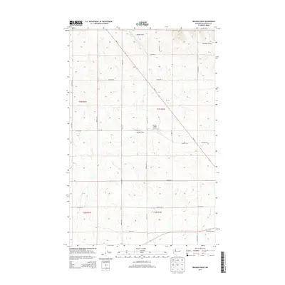
2013 Map of Broadax Draw
USGS Topo · Published 2013About this map
Broadax Draw defines this Lincoln County landscape, a terrain carved by canyons and drainage systems that supported isolated ranching operations in the early 21st century. The map highlights the localized utility of the land, featuring the Sheffels Ranch Airport and the seasonal importance of Broadax Spring. A rectilinear grid of gravel and dirt roads, including Birchill Rd N, Dawson Rd N, and Sheffels Rd N, follows the Public Land Survey System boundaries, reflecting the enduring legacy of homesteading and property division in Eastern Washington. To the northeast, the contours drop sharply into Kaufman Canyon, while the southern reaches near Wilbur Airport Rd E indicate the outskirts of regional transit hubs. This 2013 survey provides a clear view of how high-plateau agriculture and private aviation integrated into the natural geography of the Big Bend country.
Find a feature on this map
27 named features on this map. Tap any name to fly to it.
Don’t see what you’re looking for? This feature index may not catch every label — zoom into the map to look around manually.
Map Details
Editions of this 2013 Broadax Draw Map
This is the sole edition of this map. No revisions or reprints were ever made.
Other maps of this area

1948 · Grand Coulee Dam
USGS Topo · 1:62,500

1948 · Wilbur
USGS Topo · 1:62,500

1950 · Wilbur
USGS Topo · 1:62,500

1950 · Grand Coulee Dam
USGS Topo · 1:62,500

1953 · Ritzville
USGS Topo · 1:250,000

1959 · Ritzville
USGS Topo · 1:250,000

1965 · Ritzville
USGS Topo · 1:250,000

1969 · Almira
USGS Topo · 1:24,000

1969 · Govan
USGS Topo · 1:24,000

1969 · Wagner Lake
USGS Topo · 1:24,000